Cats and Bears

Contributed by John Bergman-McCool

Lately, the process of fully cataloging Adopt-A-Drawers has resulted in some interesting discoveries. The most recent of these comes from artifacts collected by Richard “Scotty” MacNeish in Tamaulipas, Mexico.

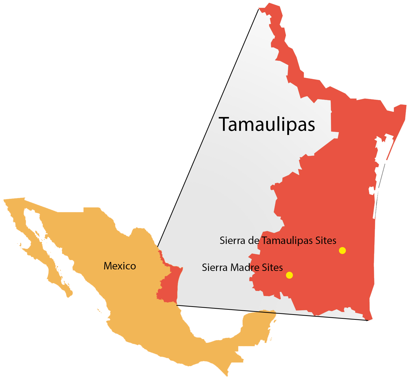
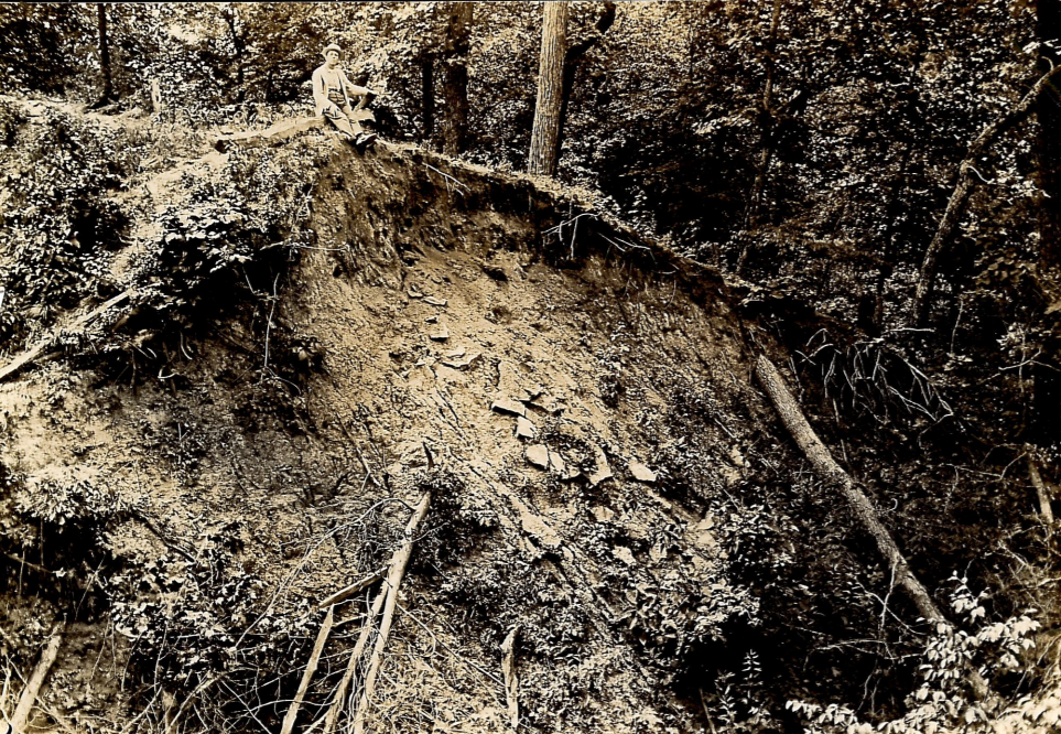
MacNeish went to Tamaulipas in 1945 hoping to find sites that predated the production of ceramics. In particular, he was searching for sites with long cultural sequences that he could use to tell the story of the development of human culture in Mesoamerica. During three field seasons, spanning  ten years, MacNeish identified and excavated several village and cave sites in the Sierra de Tamaulipas and the Sierra Madre Oriental, two mountain ranges in Tamaulipas.

MacNeish’s Tamaulipas excavation areas.

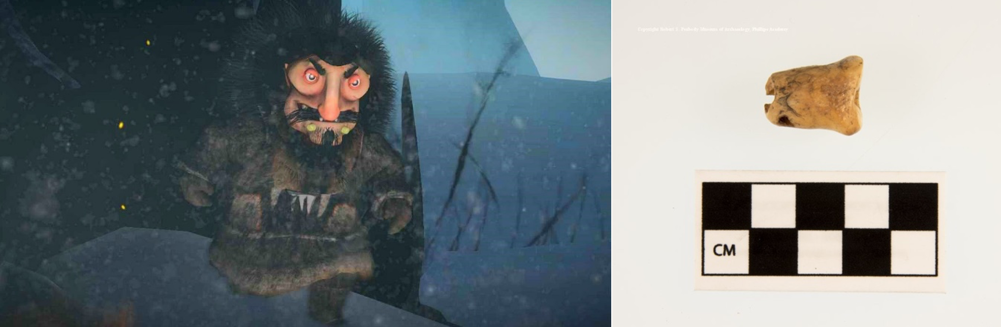
MacNeish recovered a wide variety of items from the well-preserved cave deposits in Tamaulipas. Of these were two fragmentary bear canine-shaped pendants recovered from Armadillo Cave in the Sierra de Tamaulipas. They appear to have been burnt and MacNeish believed that they were fashioned from sandstone. When compared with real canines from a bear and unknown canid, it is clear that they are an imitation. For example, the Tamaulipas pendants have no enamel and they lack the same degree of detail. However, they do approximate the shape very effectively.

Left: Two Tamaulipas bear canine-shaped pendant fragments. Middle: Dog or coyote canine pendant from Ohio. Right: Bear canine pendant from Ohio.

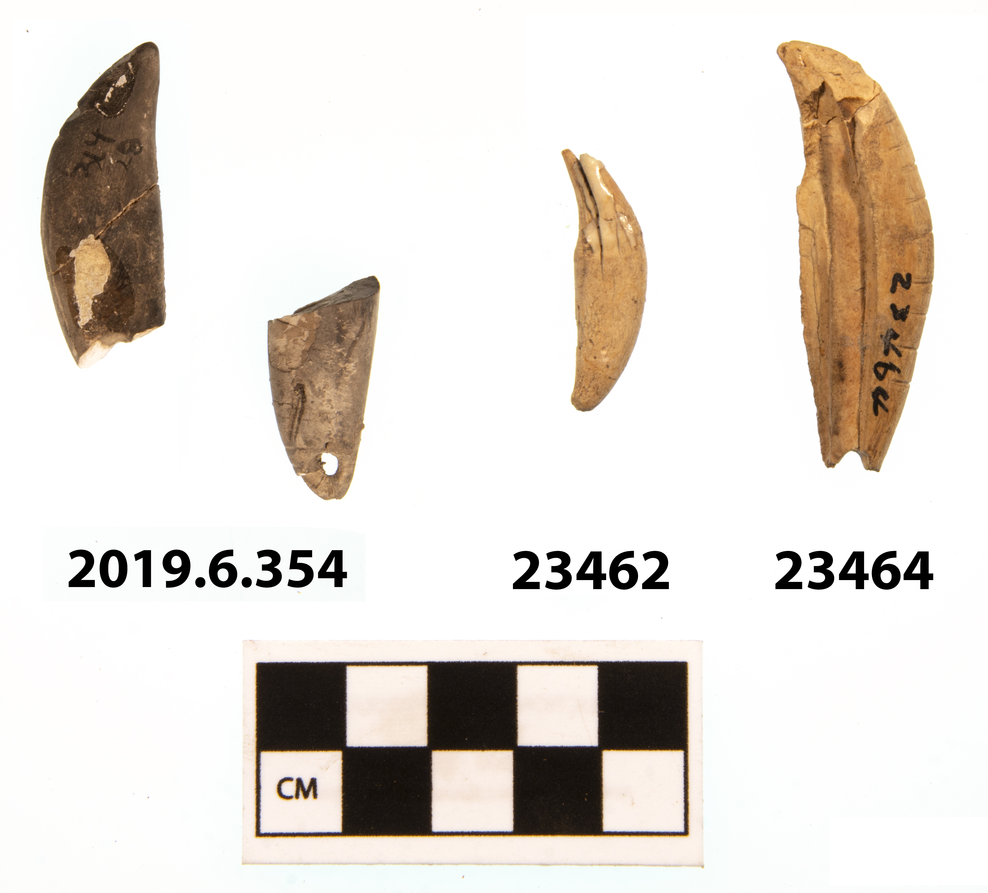
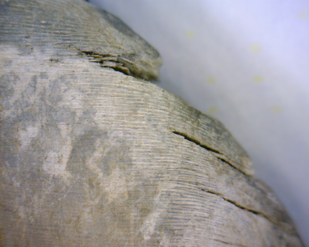
One of the pendants was fractured below a possible enamel layer so they were both inspected under magnification. Surprisingly, they show signs of very thin layering more reminiscent of the annuli of shell. I asked our Director, Dr. Ryan Wheeler to take a look at them. Among those who work here at the Peabody, he is the resident expert on shell artifacts. Dr. Wheeler agreed they were shell.

Magnified View of bear canine-shaped pendant from Tamaulipas, showing annuli.

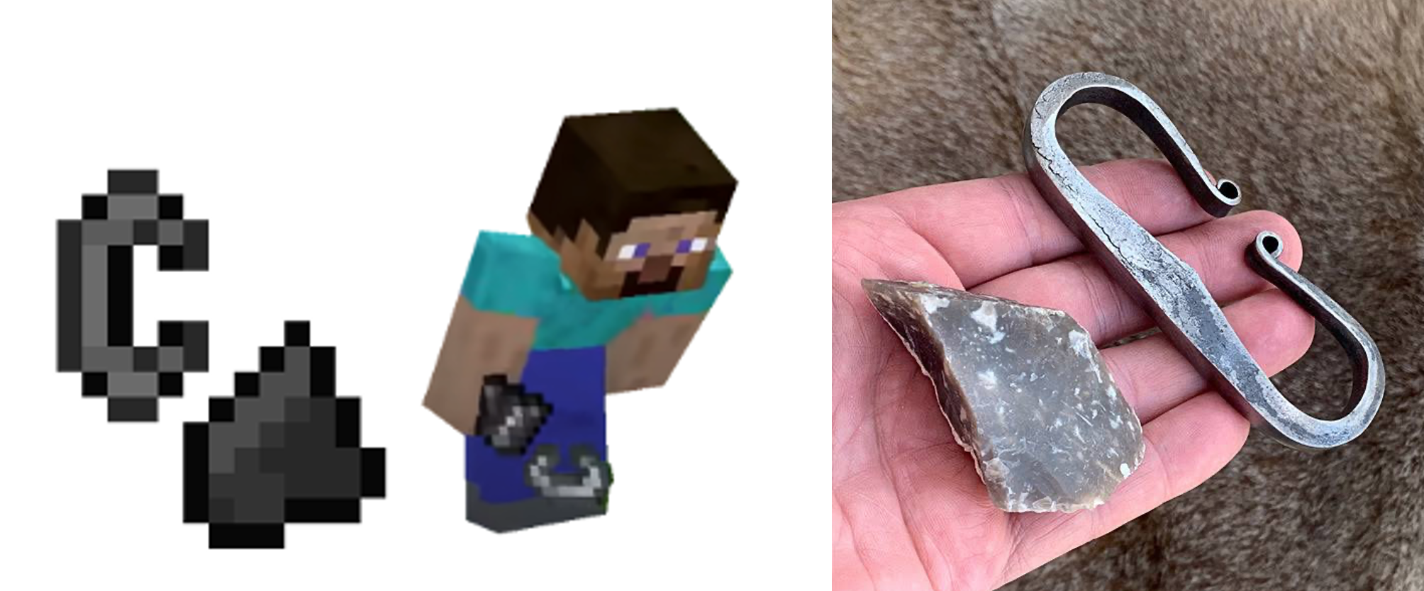
The fact that the pendants were made of shell led us to think about a possible connection with the Hopewell Culture. Several shell imitations of bear canines have been recovered from Hopewell mound sites. Additionally, the Hopewell developed a very large interaction sphere, traveling far and wide for trade materials. The Hopewell procured copper from Lake Superior, silver from Canada, obsidian from Wyoming, mica from the Blue Ridge Mountains and shell from the Gulf of Mexico.

We wondered if these pendants could have been a Hopewell trade object. Fortunately, the Peabody archives include MacNeish’s Tamaulipas excavation paperwork (digitized here). The first step to establishing a possible link was to determine the items’ age. Using charcoal from distinct layers excavated from the cave deposits, MacNeish was able to radiocarbon date the deposits. The layer containing the shell pendants dates to the Almagre Phase, roughly 2,200 to 1800BCE. This correlates to the Archaic period in the Ohio valley, about 2,000 years before the Hopewell developed. The Hopewell connection was out.

I also searched for bear remains found in northern Mexican archaeological contexts. A very quick review of available resources indicated that bear remains are not all that common in the region. The only positive return came in the form of bear long bones found at Casas Grandes in Chihuahua, Mexico. This was interesting, because the historical range of both Mexican grizzly and black bears include much of northern Mexico, including Tamaulipas state. It is very likely that humans and bear interacted in the past.

At Dr. Wheeler’s suggestion I reached out to Dr. Brad Lepper, Senior Archaeologist with the Ohio History Connection and José Luis Aguilar Guajardo, archaeologist in Tamaulipas, Mexico. They both responded with helpful information. Dr. Lepper was interested in the presence of the shell pendant and was unaware of anything similar coming from Archaic sites. He suggested consulting Cheryl Claassen’s book Beliefs and Rituals in Archaic Eastern North America for possible archaic examples, which I haven’t yet had a chance to read.

Dr. Lepper provided several examples from the Ohio History Connection’s collection of Middle Woodland Hopewell bear canine pendants (here and here) and their imitations (here and here). Some of the canines were split, or contained fresh water pearls from the Ohio River. Imitations were made from mica, copper, shell, bone, ceramic and stone.

José Luis Aguilar Guajardo was also very interested in the bear canine-shaped pendants. He was unaware of anything similar coming from sites in the Sierra de Tamaulipas mountains. He indicated that shell was a semi-precious material used for making ornamentation by the Indigenous people in the area. The Sierra de Tamaulipas mountains are quite close to the Gulf of Mexico, a source for shell materials.

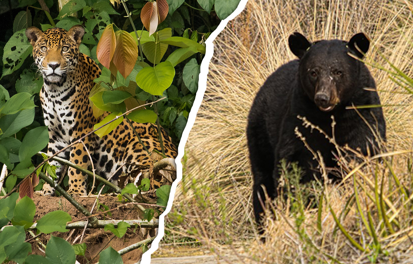
José was clear that black bears can still be found in the Sierra de Tamaulipas, and supported the possibility that they were bear-shaped. However, he suggested the possibility that they were inspired by the jaguar instead. According to José, jaguar were abundant in the area and were revered by the Indigenous people.

How to assign an animal label to the pendants becomes an interesting problem. Bear and jaguar canines can look similar in size and appearance. Understanding what the maker of the pendants intended them to represent is difficult when they cannot be asked about them directly. Both animals’ habitats overlapped in northern Mexico.

Though they don’t provide a definitive answer, some helpful articles, and their authors, that explore the importance of bear and jaguar imagery in north and Mesoamerica include: Bear Imagery and Ritual in Northeast North America, Thomas E. Berres, David M. Stothers and David Mather; Predators of Culture: Jaguar Symbolism and Mesoamerican Elites, Nicolas J. Saunders; and Rohonas and Spotted Lions: The Historical and Cultural Occurrence of the Jaguar, Panthera onca, among the Native Tribes of the American Southwest, Steve Pavlik. There are probably many, many others.

Perhaps, as José Luis Aguilar Guajardo has suggested in personal communications, Sierra de Tamaulipas falls into an area in which jaguars were strongly revered. In a very simplistic summary of the above articles, cranial remains of bears in archaeological contexts in North America have been considered a sign of bear ceremonialism. They don’t appear in MacNeish’s Tamaulipas excavations. Jaguar hides were an element of Aztec royal clothing and one of the accoutrements used by Aztec shamans. A small fragment of possible jaguar hide was recovered from the Sierra Madre excavations in Tamaulipas.

Future excavations in the area will likely bring more evidence to bear on the ritual and symbolic practices of the people of Tamaulipas.

Resources:

Archaic Bear Tooth Pendants and other related artifacts

Donaldson, William S. and Stanley Wortner

1995      The Hind Site and the Glacial Kame Burial Complex in Ontario. Ontario Archaeology 59:5-95.

Bear Imagery and Ritual

Berres, Thomas E., David M. Strothers and David Mather

2004      Bear Imagery and Ritual in Northeast North America: An Update and Assessment of A. Irving Hallowell’s Work. Midcontinental Journal of Archaeology 29(1):5-42.

Jaguar Imagery and Ritual

Pavlik, Steve

2003      Rohonas and Spotted Lions: The Historical and Cultural Occurrence of the Jaguar, Panthera  onca, among the Native Tribes of the American Southwest. Wicazo Sa Review 18(1):157-175.

Saunders, J. Nicolas

1994      Predators of Culture: Jaguar Symbolism and Mesoamerican Elites. World Archaeology  26(1):104-117.

Archaeological (Career) Explorations 

Contributed by Lindsay Randall

Back in May, I was approached by Peabody education volunteer and Triton Regional High School History teacher Lisa Herzl about a student of hers who was interested in going to college for archaeology. She asked if there were any opportunities this summer for the student to learn more about what exactly archaeology is before committing her life (and $$$$) to studying it.

I reached out to my network of archaeologists to see what might be available. And, the outpouring of support of the student’s interest was amazing. My former thesis committee member Dr. Christa Beranek wrote to me that she would be happy to give the student a tour of the site she was working on at the end of June.

The Fiske Center UMass Boston was hired to investigate the property that the Marblehead Museum recently acquired. The property sits adjacent to the Jeremiah Lee Mansion, owned and operated by the Marblehead Museum, and was the former brick kitchen and possible slave quarters owned by the Lee family. This would make the site the SECOND known, still standing, extant slave quarters in New England. 

The house and brick kitchen/possible slave quarters were built in 1766 for the Lee family. When Jeremiah Lee built his property, he made extensive changes to the land, including tearing down the Bartholomew Jackson house and leveling the land. This work essentially “capped” the previous archaeological deposits – a gold mine for the team.

Once word got to Dr. Bethany Jay (long-time Peabody collaborator) that I was going to be touring the site, she jumped at the opportunity to tag along.

Dr. Beranek was kind enough to spend over an hour with our group, not only giving us a tour of the different test pits and the artifacts being found, BUT also letting us get our hands – literally – dirty!

I have been following the investigation via the social media pages of both the Fiske Center and the Marblehead Museum and you should too! And in typical archaeology fashion, they found an amazing deposit on the second to last day. Can’t wait to see where the next stages bring them!

Ms. Herzl’s student had the time of her life and is now even more set on archaeology as a career path. Here’s to the next generation of archaeologists!

Andover Summer Returns: Dig This! class at it again

Contributed by Emma Lavoie

The Peabody is keeping busy this summer with volunteers, interns, events and visits, researchers, and of course hosting the Andover Summer Session class, Dig This!

Dig This! students in class and learning to read an excavation site.

During the month of July, the Peabody hosts the Dig This! class, a course offered by Phillips Academy’s Andover Summer Session. This Lower School initiative takes a closer look at some crucial episodes in the development of this country to hone skills and understanding of dynamic interactions that took place between Native peoples and European newcomers, which continue to shape the United States to this day.

Using the Peabody Institute’s collections, together with extensive library and internet materials, students actively explore a series of case and character studies to understand the minds and strategies of important individuals from some of the most significant events in history. In addition, students attend field trips to nearby historical sites that bring these stories to life.

Dig This! students on field trips to the Peabody Museum of Archaeology & Ethnology at Harvard and Old Sturbridge Village

Students then get to participate in their own archaeological excavation of the Mansion House at Phillips Academy – the home of PA founder, Samuel Phillips, Jr. It’s always so exciting to see what these students discover as they take part in this unique opportunity to witness history.

Dig This! students excavating the Mansion House site

Be on the lookout for more updates on students’ findings through our social media this month and maybe even a blog from one of our Dig This! class instructors!

We hope you all are having a wonderful summer!

Never Alone: Video Games and the Teaching of Culture

Contributed by Lindsay Randall

A few months back I wrote about archaeogaming and my friend Bill’s foray into this unique branch of archaeology. Little did I know that I would be immersing myself into it even more. I have even learned to play a videogame during this new endeavor! 

Tom Anderson, faculty in Computer Science at PA contacted me after reading my last blog post as he was interested in collaborating with the Peabody to do something related to videogames. 

Okay then………. game on (literally!)

Game excavated from the ATARI burial site

While learning more about archaeogaming – defined as the archaeology in and of videogames – I learned about the ATARI video game burial and excavation, countless examples of the past being incorporated into the landscapes of games such as Zelda, and explored real pieces of material culture that could be found in games such as Minecraft.

To make fire in Minecraft you need steel and flint. The graphics for the steel is often confused for a C when in fact it is a historically shaped steel fire starter.

As I was researching different avenues that the class could focus on, I stumbled upon the most amazing game: Never Alone or Kisima Ingitchuna

The game is centered on a traditional story of the Iñupiat people, and also a collaboration between the tribe and game developers. 

The game structure of Never Alone is a puzzle platformer where in order to win you must play as both Nuna, a young girl, and her fox companion, highlighting the Iñupiat ideal of cooperation and community.  

Adding depth is the inclusion of Cultural Insights throughout the game for the player to access and learn more.

For the Computer Science class, I pulled artifacts from our Arctic collections for the students to explore. The students were asked to not only work together to figure out what the artifacts are and how they were used, but to also identify which artifacts were depicted within the game. 

An example of an artifact from the Peabody collections found in the game are labrets – facial jewelry traditionally worn by men on either side of their mouth – as seen on the character Manslayer.

This was an exciting collaboration to work on and allowed me the opportunity to explore an aspect of archaeology that I only recently began thinking about. 

And recently there was an exciting announcement of a sequel to Never Alone!

Articles:

Never Alone and the need for American Indian narratives in games

How a Smithsonian Artifact Ended Up in a Popular Video Game

Updating Centuries-Old Folklore With Puzzles And Power-Ups

How a 150-year-old Tlingit robe is inspiring Alaska’s next generation of engineers

Videos:

Never Alone: the Art and the People of the Story

Aloha from Kauai

Contributed by Emma Lavoie

After two years and three rescheduled trips (thanks Covid), I finally was able to travel to Kauai, Hawaii. Of all the activities and sites to see on the island, I couldn’t miss visiting some of Kauai’s historical and archaeological sites. The Hawaiian Islands are rich with history and it was wonderful to learn about Hawaii’s culture and traditions during my time on Kauai. Here are a few of my favorite sites and some history that I learned while visiting the island of Kauai.

The island of Kauai is one of many islands that make up Hawaii. There are eight major islands commonly seen on maps, but that does not account for all of them. For many people, only the four largest of the islands usually come to mind – Big Island, Maui, Oahu, and Kauai. These islands are the most well-known, but there are actually 137 islands and 5 counties that make up the state of Hawaii.

Map of the Eight Major Islands of Hawaii

Kauai is nicknamed “the Garden Isle” for its lush green mountains and valleys and rich biodiversity. At the heart of this fertile land is Mount Wai’ale’ale. With average annual rainfall of 400+ inches, this mountain is a sustainable source of water for the island’s agriculture, drinking water, hydroelectric power, recreation, and numerous other public uses. Mount Wai’ale’ale is part of an ancient volcano that formed Kauai in its last eruption over 5 million years ago. The explosion not only gave the island its unique shape, it created the entire east side of Kauai. Today the mountain is a half moon-shaped depression (also known as a caldera). This shape combined with island trade winds, creates a large amount of fog, mist, clouds, and rainfall making this location one of the wettest places on earth!

Inside the caldera of Mount Wai’ale’ale
In 1982, the caldera had a record-setting 683 inches of rain!

Kauai has a unique history being the oldest inhabited of the main Hawaiian Islands. It was the only Hawaiian island that was not conquered by King Kamehameha, entering a peaceful resolution with Kamehameha in 1810. Later in 1864, the Robinson Family purchased over 55,000 acres of Kauai and over 46,000 acres on the island of Niihau from King Kamehameha V for $10,000 in gold (about $170,000 today). In purchasing these lands, the family promised to protect the island and its residents from outside influences. Today, over five generations later, the descendants of the Robinson family have upheld their promise requesting that 76 percent of its non-conservation lands be designated as important agriculture lands, with protection from future development.

Sugarcane was Kauai’s primary economic resource, dominating the industry until the mid-20th century. Sugar was introduced to the island by the Polynesians and later the first sugar extracting operation and mill was established in the southern town of Koloa in 1835. Soon sugar plantations developed on the east side of the island – the Lihue Sugar Plantation expanding quickly due to its fertile land around the Wailua area fed by Mount Wai’ale’ale. By the 1960’s, the sugar industry began shutting down due to labor strikes, politics, and the statehood of Hawaii. The Lihue Sugar Plantation was one of the last operating plantations, shutting down in 2000.

Although the sugar industry has since ended, many sugar plantation sites are still present. I had quite the adventure exploring the Lihue Sugar Plantation, as the site is now accessible by mountain tube. Mountain tubing?! You may ask – why of course! Picture a lazy river-experience (although not so lazy at times) down some of the plantation’s old hand-dug canals and tunnel systems circa 1870. In many of these tunnels, you can still see the marks from workers’ pickaxes. Workers tried to save time and extend one of the tunnels with dynamite. This technique was discontinued after their first try, but a large chamber in the tunnel ceiling remains.

Lihue Sugar Plantation Canal, circa 1870

Mountain tubing the Lihue Sugar Plantation canal and tunnel system

My favorite location on the island was the Honopu Valley, located along the Napali Coast. The Honopu Valley is one of the most beautiful and mysterious sites with cathedral cliffs that reach up to 1,200 feet. Much of this side of the island is inaccessible by road and is best visited by helicopter or boat. The Honopu Valley, also known as the Valley of the Kings, is the source of many Hawaiian legends. For this reason the site is the most remote and secluded along the coast, being extremely difficult and dangerous to access due to the spiritual significance of this burial site.

The Napali Coast on the island of Kauai

Legends aside, the Honopu cliffs were used as burial sites for ancient Hawaiian Ali’i (royalty) that ruled along the Napali Coast. Hawaiians believed that their chiefs were direct descendants of gods and their remains contained powerful mana (life force).  To avoid the mana falling into the wrong hands, a chief’s remains needed to be buried in a secret location.

Honopu Valley (Valley of the Kings)

Warriors, chosen from birth, were designated to bury the chief’s remains in the cliff walls. They would either climb hundreds of feet up the steep cliffs or lower themselves down the cliff walls by rope in search of a suitable location for the chief’s remains. Once carefully buried in the cliff walls, the warrior would jump or cut their rope, falling to their death – securing the location’s secrecy forever.

The Department of Land and Natural Resources limits visitors to this site out of respect for the sacred history of the Honopu Valley, although there have been several exceptions to these regulations for Hollywood, with movie scenes of Honopu filmed in King Kong (1976), Six Days Seven Nights, Pirates of the Caribbean: On Stranger Tides, Raiders of the Lost Ark, Honeymoon in Vegas, and Jurassic Park 3.

It is quite remarkable to see these cliffs from air and water, knowing the honorable yet fatal task these warriors were selected for. It is said, to this day, the remains of these warriors can be seen in the sand dunes underneath the cliffs after being exposed to heavy rains or winds.

Coastal hiking trail view – Cliffs above Shipwreck Beach

After a two mile hike along the coastal trail from Shipwrecks Beach, you’ll come across a site frozen in time – the Makauwahi Cave Reserve. From above, the reserve looks like a tropical oasis amongst the rocky, volcanic cliffs and dune vegetation. If you’re lucky enough to find the cave’s entrance you can expect to be greeted by a small hole in the cave wall that visitors must crawl through as their rite of passage into the cave. Once through, you’ll emerge from the dark, cavern entrance and step back in time to Hawaii’s largest limestone cave and fossil site.

Entrance to the Makauwahi Cave

For over 100,000 years, water has seeped into the cave and eroded the limestone. As a result, 7,000 years ago a large section of the cave ceiling collapsed, leaving behind a vast oval opening to the sky. This formation created a unique time capsule of geological change and biological occupation.

The thick walls of the Makauwahi Cave preserves over 10,000 years of animal fossils (shells and bones) and plant fossils (seeds, leaves, and wood.) From a 352,000-year-old lava flow to a Styrofoam cup washed in by Hurricane Iniki in 1992, the prehistoric sinkhole preserved everything and anything that fell into it.

The Makauwahi Cave Reserve from above

Today, archaeologists and paleoecologists study the cave’s sediment layers and fossils to understand the prehistoric landscape and its change overtime. Using innovative restoration techniques, researchers and scientists are experimenting in native species conservation with abandoned farms and quarry lands surrounding the site. Through this initiative, acres of forest land, dune vegetation, and wetlands are being restored, featuring many species of native plants and endangered species such as waterbirds and blind cave invertebrates. There’s even a giant tortoise sanctuary in one of the wetland reserves near the cave! Learn more about the Makauwahi Cave Reserve and its current restoration project here!

Meet Maurice, a 20+ year old giant tortoise from the Makauwahi Cave Reserve Tortoise Sanctuary

An Unusual Item

Contributed by John Bergman-McCool

Recently, an unusual item was found while processing one of our adopted drawers. The Adopt-A-Drawer program lets donors support the full cataloging of artifacts housed at the Peabody. Every time a drawer is adopted we measure, weigh, photograph, and house the contents in archival storage. Beyond documentation and storage, adopted drawers represent a chance to dig deeper into the stories of the items held here at the Peabody.

Figure 1. Example of an unmodified turkey ulna (top) and flute made from ulna.

The item in question was one of two bone flutes stored in the adopted drawer (figure 2). According to our catalog, they were both from Pecos Pueblo, a site in New Mexico situated in the Upper Pecos Valley east of Santa Fe. One of the flutes is labeled with a number that indicates that it was previously uncataloged and found with material from Pecos. At some point in the past, it had become separated from its provenience information.

When comparing the two flutes they are similar in most ways. They are both made from bird bones with the ends removed to make a hollow tube (sound chamber) that is open on both ends. They also share the same configuration of holes. There is a larger hole near the proximal end of the bone and three smaller holes at regular intervals near the distal end of the bone.

Where they differ is that the uncataloged flute’s sound chamber is plugged at the proximal end by a dark material with a vitreous luster. It immediately brought to mind resin, an Indigenous adhesive material that I knew of but had never seen in a decade of working as an archaeologist. The position of the plug suggested that this instrument was played like a transverse flute, which was eye opening.

Figure 2. The two flutes with view of openings at proximal end.

­I looked for information on other flutes from Pecos and fairly quickly came across an article authored by Richard W. Payne for Kiva, an archaeological journal published by the Arizona Archaeological and Historical Society. Mr. Payne was a trained medical professional with a lifelong interest in Native American flute music. You can find more information about him here and a bibliography of his writings on native flute traditions here. He is considered one of the driving forces behind the rejuvenation of the Native American (or Plains) flute, which is its own fascinating story (Conlon 2002).

Payne’s article is fairly technical, being written from the perspective of a person with years of flute playing and experience with musical theory. Neither of these subjects are in my wheelhouse. On the first read, the most interesting points concerned his visual analysis of bone flutes from Puebloan sites. Among other suppositions, he suggests that the sound window shape can determine how the instrument was played (figure 3). Round holes could serve as the embouchure of a transverse flute or as tone holes of for an end blown flute. Notched holes could be played from either end. Triangle or square holes suggest ducted flutes. (Payne 1991)

Figure 3. Examples of sound windows with arrows to indicate wind direction and cross-section showing sound chamber. a: Transverse flute with plug. b: End blown flute, with wind blowing across the open end. c: Notched, making a hole with fipple edges to allow play from either end (my best guess). d: D-shaped window of a ducted flute with interior duct to direct air flow.

In discussing the bird bone flutes of Pecos, Payne notes that the site was occupied until the nineteenth century and that bone flutes from later contexts show evidence of European influence. Frustratingly, the claim isn’t supported with examples. Further, he mentions an article by Charles Peabody, the first director of the Peabody, wherein a flute from Pecos produced musical tones equivalent to a tabor pipe, again suggesting Western influence (Payne 1991).

The article by Charles Peabody, a talented flautist and ethnomusicologist, among other things, was written in 1917. In it, he describes asking Alfred Kidder for permission to experiment with a bone flute that was recovered while visiting Pecos during the 1916 season’s excavations. Permissions secured, those experimentations included inserting a plug of modeling clay in the proximal end of the flute. Prior to the insertion, the instrument played tones that were “excessively shrill.” After the insertion, the flute played several tones within the C sharp scale. A figure of the flute is included in Charles Peabody’s article (Peabody 1917).

When a comparison is made of the flute in Peabody’s article and the flute in question, it is clear that they are indeed one-and-the-same. The most likely scenario is that Charles Peabody acquired the flute at Pecos before it was cataloged. Eventually, it made its way back to the Peabody and was returned to the collection. By the time it was found with other materials from Pecos, all institutional knowledge of the item had been lost. Fortunately in this case, there was some record of its history.

With the story of the flute’s provenience resolved, there seems, to me, to be other questions left unanswered. These are the references to Western influence in both the musical tones and the flutes themselves suggested by Richard Payne and to a lesser degree, Charles Peabody. I’ll address those in a follow up blog.

References:

Conlon, Paula

2002       The Native American Flute: Convergence and Collaboration as Exemplified by R. Carlos Nakai. The World of Music 44(1): 61-7

Payne, Richard W.

                1991       Bone Flutesof the Anasazi. Kiva 56(2): 165-177

Peabody, Charles

                1917       A Prehistoric Wind-Instrument from Pecos. American Anthropologist n.s 19: 30-33

Video Game Archaeology

Contributed by Lindsay Randall

Sourdough starters. Knitting. Jigsaw puzzles.  These are a few hobbies that people have taken up during the pandemic. 

My friend Bill – assistant professor of anthropology at Southern Connecticut State University – has taken up something completely different and unusual. He has been creating videos that use his archaeological training to explore the vast worlds of……….video games.

Yup. My friend Bill is the ultimate geek. Dork? Nerd? Well, whatever the terminology, he is letting his “flag fly” for all on the internet to see.

At first, I was a little dismissive of his work since I am not a video game person. My exposure to video games of any type was in the 90s when my older brother and his friends would play in our living room – on the one TV in the house – and I would lay on the couch mindlessly watching simply because I was too bored to do anything else. Besides, how on earth do video games have anything to do with archaeology?!?! 

But, I was slightly intrigued and figured “why not” and sat down to watch one of the episodes to kill some time. Faced with a jumble of names that I had never heard before, I clicked on the one name with which I was slightly familiar: Zelda.

I’m not sure what I was expecting, but it certainly was not to be hit with a wave of nostalgia watching Bill’s breakdown of Zelda: Breath of the Wild when his commentary referenced the Zelda games that I watched my brother play while I passively hung out with him. Nor was I expecting the archaeologist in me to be sucked into his breakdown of the sense of place and world building of the game using archaeological concepts and theory. And I certainly was not expecting NAGPRA or the story of the famous Kennewick Man to pop up.

And, to all the Star Wars fans out there – you should tune into his exploration of The Book of Boba Fett and its use of colonialist themes and tropes.  My mind began thinking of all the ways that I might use Bill’s work on this as a lesson for my students as I watched the 15-minute video. I highly recommend it.

For my own personal enjoyment, I’m hoping that a future video will explore the domestication of chocobos from Final Fantasy. No idea what a chocobo is or does, besides maybe letting a character ride it, but I always did think they were cute.

If you are interested in learning more, please join the Gene Winter Chapter of the Massachusetts Archaeological Society on Tuesday March 15 at 7 p.m. when Dr. Bill Farley will discuss video game archaeology. To register for the zoom link email info.nechapter@massarchaeology.org.

Completion and Consumption: Ties to Tuberculosis in the Peabody Collection

Contributed by Emma Lavoie

Last month we were happy to announce that the Peabody officially completed its collection inventory! Special recognition goes out to our previous Inventory Specialists John Bergman-McCool and Emily Hurley, our financial supporters, as well as our volunteers, work-duty students (past and present), and Peabody collection staff who’ve participated in inventorying the collections from 2017 to present.

Reflecting back on all the drawers I personally inventoried and rehoused, there was one particular item and site that I wanted to share. This item is a large, chipped stone knife from the Swamp site in North Reading, MA.

Item 42/6529 – One large, chipped stone knife from the Swamp site in North Reading, MA.

After looking through the Peabody’s accession file cards, I found more items from the same site consisting of various stone points, perforators, gouges, and knives. The most interesting discovery from my search was the location where these items were found. The land in which the Swamp site was located was at one point in time the location of the North Reading State Sanatorium.

Accession file card detailing the objects were found by Mr. Margerison at the North Reading Tuberculosis Hospital site and sold to Dr. Moorehead by Mr. Margerison’s son.

According to a 1933-1935 survey by the Council on Medical Education and Hospitals of the American Medical Association, the term “sanatorium” is an institution operating exclusively for the treatment of tuberculosis. Originally called the Martin’s Brook Sanatorium, the North Reading State Sanatorium was one of four hospitals in Massachusetts for patients with tuberculosis, opening in 1909. The property consisted of 23 structures on 87-acres of land, including a church and school.

During this time, tuberculosis (also known as consumption) was the leading cause of death in both the United States and worldwide, most prevalent amongst teens and adults under 40. Fresh air was considered one of the best ways to treat the disease and was one reason why the North Reading location was chosen for the sanatorium.

View of an open porch – a method of protecting porches by canvas curtains in stormy weather. John A. Fox, Architect. North Reading State Sanatorium, North Reading, MA.
Image from the Tuberculosis hospital and sanatorium construction, written for the National Association for the Study and Prevention of Tuberculosis by Thomas Spees Carrington, 1911.

In her 2013 presentation, “The Martin’s Brook Sanatorium: The History of Care in North Reading and the Commonwealth,” Dr. Clarisse A. Poirier of Merrimack College shares that the earliest structures on the property had no walls in order to give patients plenty of fresh air. Canvas curtains would also be set up in colder weather in order to protect patients from the elements. In addition to the open porch design, the North Reading Sanatorium buildings were “lean-to” structures with a central interior sitting room that overlooked a wing of open porches on either side.

The “lean to” design of the North Reading Sanatorium structures. Image from the Tuberculosis hospital and sanatorium construction, written for the National Association for the Study and Prevention of Tuberculosis by Thomas Spees Carrington, 1911.

By 1926, the sanatorium became a facility solely for children with tuberculosis. Adult patients were moved from North Reading to other facilities at Lakeville, Rutland, and Westfield. By 1945, North Reading received children suffering from the rheumatic fever epidemic and in 1958 the facility received children suffering from any chronic diseases.

North Reading, MA State Tuberculosis Sanatorium West Ward, circa 1910 postcard

After the sanatorium closed in 1962, the property became the John T. Berry Rehabilitation Center until 1995. Part of the land was then sold in 2006 to Lincoln Properties and the other half in 2017 to Pulte Homes. From 2005 to 2008, the Public Archaeology Laboratory (PAL) completed archaeological data recovery programs for five ancient Native American sites located on the property. These projects were completed in advance of the business/residential properties that would later take over the 87-acres of land that once held the former North Reading Sanatorium and John T. Berry Rehabilitation Center. Today the site is now the location of the Edgewood Apartments and the Martin’s Landing Condominiums off of Lowell Road.

The John T. Berry Rehabilitation Center (also known as the JT Berry State School) 1962-1995. Photo courtesy of Asylum Projects.

The archaeological investigation yielded more than 14,000 items consisting of chipped and ground stone tools, knapping debris, fire pits, storage and trash pits, and rock clusters. The evidence identified that the site was pre-contact and used by Middle and Late Archaic populations about 8,000 to 3,000 years ago.

The items in the Peabody collection from this site were discovered by a Mr. Margerison and sold to Dr. Warren K. Moorehead by Mr. Margerison’s son before 1940. Perhaps Moorehead’s decision to obtain these items from the North Reading State Sanatorium site stemmed from his own battle with tuberculosis.

Moorehead had been diagnosed with tuberculosis in 1895. A year later he became associated with Robert S. Peabody, curating artifacts from various sites for Peabody’s personal collections. He moved to the east in 1898 to recover from his illness at Peabody’s cabin in Saranac Lake, New York. This was also the location of the Adirondack Cottage Sanatorium at Saranac Lake (also known as the “Cure Cottages”) established in 1884. Perhaps Moorehead spent some time here as well during his recovery.

Adirondack Cottage Sanatorium, Adirondack Mountains, Saranac Lake, NY. Postcard circa 1902-1903. Image courtesy of the New York Public Library Digital Collections.

What many do not know, is what was believed to be the cause of Moorehead’s illness. In 1888, Moorehead was involved in an excavation accident where a wall of earth collapsed on him in the excavation unit, burying him alive. According to an article in the Phillips Academy student newspaper, the Phillipian, Moorehead was paralyzed from the waist down for several days after the accident and he later developed a case of pulmonary tuberculosis as a result.

To learn more about Moorehead’s experience on being buried alive, check out my blog – Buried Alive: A Grave Situation for W.K. Moorehead.

After his accident and development of tuberculosis, Moorehead eventually (with the help of his friend Robert S. Peabody) made his way to New England. By 1901, Moorehead arrived to the newly-founded Department of Archaeology at Phillips Academy in Andover, MA (now the Robert S. Peabody Institute of Archaeology), serving as curator, 1901-1924, and Director, 1924-1938 before his death in 1939. A private struggle for life by Moorehead, but none the less an extraordinary rebirth by the time of his curatorship at the Peabody at the beginning of the twentieth century.

REVOLTing Art: Understanding the Pueblo Revolt Through Modern Art

Contributed by Lindsay Randall

The Pueblo Revolt was a pivotal moment in the history of the Southwest region of what is now the United States. 

In 1680 the numerous Pueblos unified under the leadership of Po’pay and fought back against the military, religious, and political incursion of the Spanish. This event is the only successful large scale Indigenous revolt against Europeans in North America, and as such is covered in History 201 at Phillips Academy.

While there are numerous accounts of the Revolt from a Spanish perspective, many academics agree that there are no known comparable accounts of the event from the perspective of the Pueblos. 

But what are “comparable” sources anyway? Because there are Indigenous accounts from that time period and contemporaneous to the known Spanish accounts – They are just in the form of oral traditions. Unfortunately, oral traditions have historically not been treated as the same as written or archaeological evidence.  

I wanted to change how our students interacted with material about the Pueblo Revolt and so I created a new lesson that gave more weight to the Pueblo experience, in their own words. And thankfully, Dr. Marisela Ramos, History Department Head was more than happy to let me use her classes to experiment and refine my lesson.

Jason Garcia ceramic in the Peabody’s collection

Artist Jason Garcia (Tewa name: Okuu Pin) has created numerous and stunning pieces related to the Pueblo Revolt using traditional comic book imagery, including a ceramic pot that is in the Peabody’s collection. He has also crafted a multi piece series of art titled Tewa Tales of Suspense! which continues his efforts to provide a counterpoint to the common Spanish-dominant narrative of the Pueblo Revolt. 

Using a set of pictures from the expansive series, I crafted a lesson which engages students in close reading of the visual images to understanding this particular event in history. 

After working in groups and spending time exploring the details of a single picture, students report back to the whole class about what information their picture is conveying, before working collaboratively to place all the images in chronological order. As the class orders the images, we discuss how the narrative of each single picture contributes to our understanding of the larger story of the Pueblo Revolt.

Then we look at quotes taken from a letter by Governor Don Antonio de Otermin and students attempt to match the quotes to the corresponding image.

We end the class with a discussion regarding the differences in how a single event is portrayed depending on the viewpoint and medium (visual narrative vs. written account) as well as why it is important that oral traditions be given the same authority as written documents. 

This lesson has been an exciting way to engage students with the history of the Pueblo Revolt through comic book style art and I look forward to finding ways to refine and expand the activity.

Buried Alive: A Grave Situation for W.K. Moorehead

Contributed by Emma Lavoie

Example of the sheer size of an earthen wall and the dangers of excavating and tunneling into mounds.
Washout on the wall, west side of new fort, Station 363, Fort Ancient site, Ohio.
Peabody Photo Collections, Plate IX

Originally, I was going to share a blog about tuberculosis and its connection to the Peabody collections, but when this story came up in my research, it was too interesting to set aside to wait another month! For those who are intrigued by how consumption is tied to the Peabody and its collections, you’ll have to wait in anticipation for another month.

I must first give special thanks to the Peabody’s independent researcher, Adam Way, who found this story in an article from the Phillips Academy student newspaper, the Phillipian. This was hours after I asked him to keep his eyes peeled for specific details about Moorehead. What a happy coincidence this find made for my research. Thank you again Adam!

During his excavations in the summer of 1888, Warren K. Moorehead was buried by a cave-in which almost cost him his life. To best share this story, I think it would be best for you to hear some of the story from W.K. Moorehead yourself!

After all, the fall season is upon us and where many believe Moorehead’s spirit lives on within the Peabody’s walls, I couldn’t think of a more appropriate time for him to share this near-death experience in his own words. Enjoy!

According to Moorehead’s Field Diary of an Archaeological Collector, 1902, and his written account for the journal, Science, Moorehead was excavating a large mound near Frankfort, Ross County, Ohio in August 1888.

“Here a serious accident befell me… as I bent down to examine a small bone uncovered in the process of undermining, a mass of earth equal to several cartloads suddenly dropped from above.” 

– W.K. Moorehead, Field Diary of an Archaeological Collector (1902)

As Moorehead bent down to examine the bone, the workmen climbed out of the unit to cut down the undermined wall of the mound. As a result, the wall of earth fell upon Moorehead burying him alive.

“The rush of wind it causes I well remember. My head and shoulders were somewhat higher than my legs, possibly a foot. The feet were spread apart. There was little pain, only pressure, intense pressure. It forced the buttons of my light field costume partly inside the flesh; my watch-chain left a bright-red mark along my left side. I could feel the watch strongly pressed against two ribs (these were broken.) The skin over my forehead seemed being cut, but it was the pressure of my hat forcing the flesh between the laced straws. A knife in my pocket seemed burningly hot. Just under the small of my back lay a large clod. The pain at the point of contact was considerable at times, and my spinal column seemed slowly breaking. Then the pain stopped and I could feel nothing.”

– W. K. Moorehead, Buried Alive – One’s Sensations and Thoughts (1893)

Throughout this entire experience, Moorehead described being unable to move, unable to breathe, unable to even wink. He recounts how hot the earth was against his face as the pressure of the earth forced his last breath. The workmen said it took a minute or more to reach his head.

“I felt the earth move slightly above my head. That gave me hope. I had not thought much of rescue, but I gathered my remaining strength. A shovel passed across the top of my head, cutting the scalp; I remember feeling it as if a hot iron had struck me. Then they uncovered my head and removed the earth from my mouth and eyes.” 

– W.K. Moorehead, Ibid.

After he had been removed, he was partially paralyzed for several days. An article in the Phillips Academy student newspaper, The Phillipian, stated that Moorehead was paralyzed for five to six weeks and later, at the order of a spinal expert, he was placed in a straightjacket to put the weight of his upper body on to his hips to relieve his spine.

“I neglected to state that the earth above my head was about three feet thick, that over my legs was much deeper. Many persons buried in gravel pits and in earth not nearly so deep have been taken out dead.” 

– W. K. Moorehead, Buried Alive – One’s Sensations and Thoughts (1893)

The physical effects were quite severe, but it was the effects of the accident on Moorehead’s mind that remained with him throughout the rest of his life. Dreams of caving banks and recurring memories of the accident haunted Moorehead’s psyche.

“I cannot now enter a mine or cave, or stand near an overhanging bank without a feeling of horror.” 

– W.K. Moorehead, Field Diary of an Archaeological Collector (1902)

The results of this accident continued to echo throughout Moorehead’s later life, affecting his mind and his health. In my next blog these echoes will be revealed.

For more information about this story, please visit the following sources.

Buried Alive – One’s Sensations and Thoughts, Science Magazine, Vol. ns-21, Issue 522, February 3, 1893

Field Diary of an Archaeological Collector, 1902

The Phillipian: Dr. Moorhead Tells, In Book Of Explorers’ Tales Just Out, How He Was Buried Alive (January 30, 1932)